


Site scanning specialist Navvis has pitted its VLX wearable mapping system against a more conventional terrestrial laser scanner with startling results.
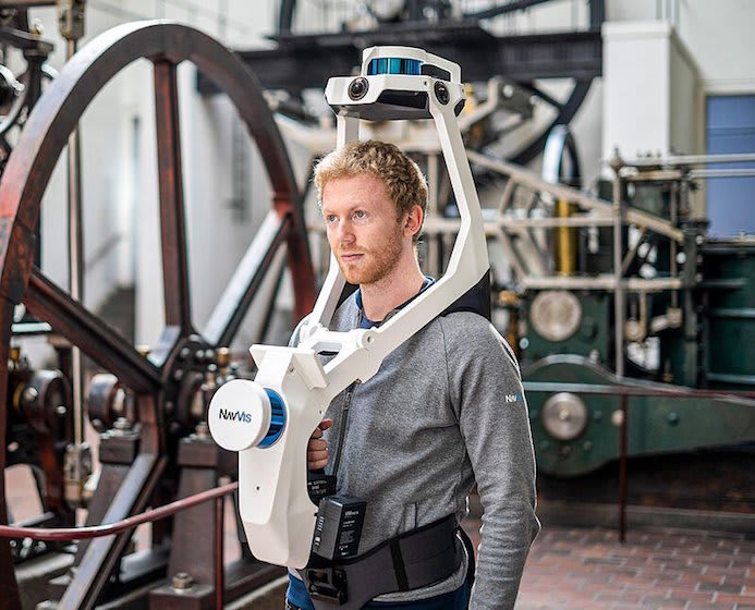
The VLX is equipped with two LiDAR sensors and four cameras, allowing it to “quickly and efficiently capture survey-grade point clouds… and capture high-resolution panoramic images in a complete 360 degree field of view”, Navvis said.
The VLX positions the hardware on the front and top of the operator. This provides several advantages over backpacl models, Navvis said: “Wearing the device on the front enables the operator to have more control over where the sensors are scanning, which improves data quality. The operator is also able to view and interact with the built-in screen that provides live feedback of what has been scanned and the quality of the data being captured.”
Register for free or sign in to continue reading
This is not a paywall. Registration allows us to enhance your experience across Construction Management and ensure we deliver you quality editorial content.
Registering also means you can manage your own CPDs, comments, newsletter sign-ups and privacy settings.