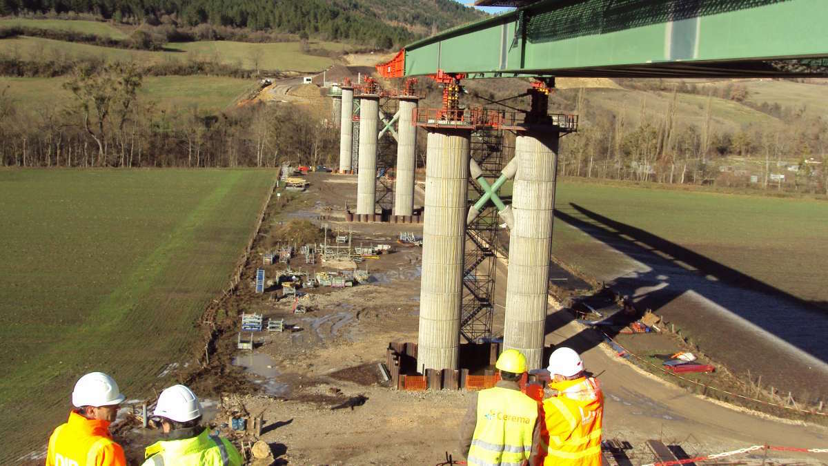
The agency had to identify most of the country’s municipal bridges and determine their condition, collecting data and mapping results with GIS technology.
This is not a paywall. Registration allows us to enhance your experience across Construction Management and ensure we deliver you quality editorial content.
Registering also means you can manage your own CPDs, comments, newsletter sign-ups and privacy settings.
The bridge assessment task faced three major obstacles. First, France has more than 36,000 road authorities, including many smaller municipalities, towns and villages with limited financial and technical resources. Second, the sheer number of bridges that needed evaluation was staggering, with estimates of as many as 100,000. Third, the French government didn’t have an inspection programme in place to determine the condition of local bridges.
Thomas Plantier, director of digital transformation at Cerema, noted other considerations: “The theoretical lifespan of a bridge varies according to the type of structure, how it’s used, and above all, its surveillance and maintenance.”
To tackle the bridge census and assessment, Cerema staff coordinated 250 agents from 30 different contractors over a two-year period that finished last year. Cerema also needed to establish ongoing communication with many local authorities from the 11,500 participating municipalities.
The timeline was tight as Cerema had only six months to prepare and 18 months to carry out the entire census. “Such a massive programme requires a dedicated information system,” Plantier said.
The data challenge
Cerema staff and contractors had to be able to enter data, including location and images, while in the field and possibly offline. In the office, they needed a database, a public map, and a health diary of each bridge and its associated retaining wall. Management wanted to visualise the data and monitor progress, and the agency had to compartmentalise contractor information for data security. Most importantly, the tools had to be easy for all stakeholders to use.
Thus, Cerema gave crews access to Esri’s ArcGIS Survey123, a mobile GIS app for phones or tablets. “The survey included about 150 questions for each type of structure, and there was also the 12-page health diary that required a lot of conditionality management,” Plantier said.
In total, the team of 250 field agents surveyed 45,000 of France’s bridges and retaining walls. Office staff created interactive dashboards using ArcGIS to display inspection progress and results.
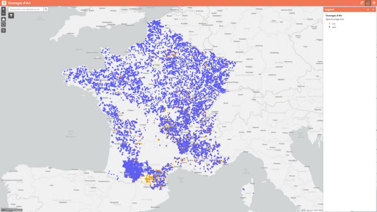
With a picture of the current condition of thousands of bridges and retaining walls across France complete, Cerema created an interactive online map accessible for public use, bringing together all the data (image above).
Data-driven results
Ultimately, the assessment showed that 10% of the structures surveyed required immediate attention to ensure public safety, and 21% needed significant repairs. Enabled by these data-driven results, renovations have already begun. Cerema has also created guides and videos to help local authorities maintain bridges into the future.
The project is ongoing. Additional municipalities – those that had declined to join the programme initially – have agreed to participate after seeing the census results.
“The data-driven and map-focused results of the National Bridges Programme has helped solidify the role of Cerema as the authority on bridge and infrastructure quality,” Plantier said. “That data-driven effort, using GIS-based surveys, is a pattern we plan to apply for other initiatives.”
This is not a first step towards a paywall. We need readers to register with us to help sustain creation of quality editorial content on Construction Management. Registering also means you can manage your own CPDs, comments, newsletter sign-ups and privacy settings. Thank you.