Construction Management is the highest circulation construction-based publication serving the UK built environment.
Digital Construction
Geospatial seabed mapping paves the way for clean energy
Katie Coyne Contributing Editor
A physical demonstration from the Crown Estate shows how offshore wind planning works
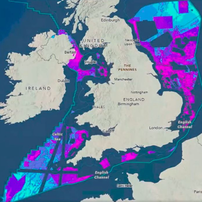
The Crown Estate has revealed details of its geospatial project mapping the UK seabed.
The Crown Estate’s marine and digital teams have developed a spatial planning system to help determine seabed use around England, Wales and Northern Ireland up to 2050.
The planning system collects data from 250 sources across 10 sectors. It weighs demand on the seabed from sources including offshore wind, carbon capture, telecoms and minerals, against protecting nature.
This is not a paywall. Registration allows us to enhance your experience across Construction Management and ensure we deliver you quality editorial content.
Registering also means you can manage your own CPDs, comments, newsletter sign-ups and privacy settings.
Different scenarios are considered and compared in a dashboard to understand their impact.
The Crown Estate has an internal remit to ensure environmental, industrial and social interests and constraints are equally considered.
Crown Estate spatial planning director Michelle Moore said: “With an increasingly busy seabed, it is critical that development decisions are based on robust data and evidence.
“Advanced Esri spatial analysis tools allow us to tackle complex, multidimensional problems in an open and transparent way.
“Our unique ability to plan for the long-term and convene a wide range of stakeholders, helps us to balance all interests to achieve the best outcomes for net zero, nature and economic growth.”
Clean energy delivery
This follows an announcement that the Crown Estate, which manages a portfolio worth £16bn, has entered a partnership with the new state-backed GB Energy to help deliver clean energy.
Geospatial seabed mapping will help protect nature and deliver clean energy
The partnership will help create new offshore wind farms and has potential to attract up to £60bn in private investment.
Managing director for marine, Gus Jaspert, said: “Geospatial innovation is helping the Crown Estate balance a green energy transition to net zero and nature recovery whilst creating a thriving marine economy.
Jaspert added the project was delivering, “world-leading work in spatial analysis using Esri software, and [was] a demonstration of our ongoing investment in digital technology and skills”.
“It helps make sense of highly complex and competing demands on the seabed, driving better planning decisions for the benefit of the nation for years to come.”
Esri UK managing director Pete Wilkinson said: “The Crown Estate’s approach is a best-in-class example of how geospatial expertise can deliver valuable outcomes. True innovators in marine spatial planning, the team’s work is of national importance.”
This is not a first step towards a paywall. We need readers to register with us to help sustain creation of quality editorial content on Construction Management. Registering also means you can manage your own CPDs, comments, newsletter sign-ups and privacy settings. Thank you.