Construction Management is the highest circulation construction-based publication serving the UK built environment.
Digital Construction
Digital twinning Vodafone’s mobile mast network
Justin Stanton Editor, CM Digital
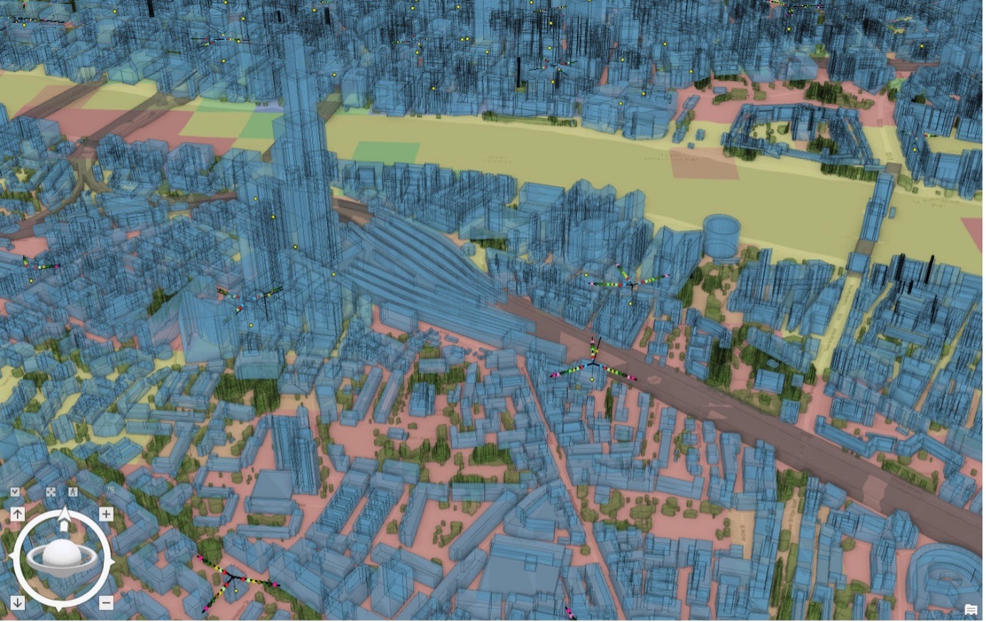
An image from Esri showing Vodafone’s twin of the London Bridge area
Vodafone has created a digital twin of its UK mobile mast network using software from Esri UK. This allows its engineers to visualise and strategise network improvements or expansion.
The digital twin involved mapping more than 40 million environmental features, including buildings, hills, valleys and trees. It uses software from geographic information system (GIS), location intelligence and mapping company Esri.
Engineers now have access to a 360-degree virtual view of the network from their laptop or mobile device. They can plan where to position new mobile sites more effectively and identify which ones need upgrading or repositioning to meet increases in customer demand, or to compensate for the construction of new buildings or tree growth.
Dr Rebecca King, GIS lead at Vodafone, explained: “A customer’s mobile phone might cut out due to what we call clutter. This is usually down to the construction of new buildings or seasonal tree growth interfering with the signal strength. We like to visualise these in a digital format so that we can better plan the expansion of our network around them.”
This is not a paywall. Registration allows us to enhance your experience across Construction Management and ensure we deliver you quality editorial content.
Registering also means you can manage your own CPDs, comments, newsletter sign-ups and privacy settings.
Approximately 500,000 network features, such as antennas, along with billions of rows of network performance data, can be visually presented. With a few clicks, an engineer can inspect a component of a mobile base station remotely before deciding whether to travel to the site to carry out any work.
Boris Pitchforth, lead architect at Vodafone, added: “The digital twin gives us an unprecedented understanding of our entire UK mobile network. It is like Minecraft for data scientists.
“We can be smarter and faster about how and where we add new 5G features, and target capacity increases with greater precision. There’s also the added benefit of being able to reduce our carbon footprint as our engineers won’t need to make as many site visits, especially to masts in remote areas.”
Twin focuses on real-world dimensions
Working with the UK arm of Esri, Vodafone used satellite data to map the terrain, including land use such as crops, transport links and height data of neighbouring objects. “The digital twin doesn’t need to exactly replicate objects in the real world such as the individual bricks of a building, only its dimensions, so that we can angle the signal to give customers the best possible connection. The simpler the map is, the faster it loads,” Pitchforth explained.
Vodafone is using Esri’s ArcGIS Enterprise platform. This combines web mapping, image exploitation, real-time data handling, large-volume batch analysis and spatial data science.
“A few years ago, a national digital twin of this type simply wasn’t possible,” said Pitchforth. “But the combination of ArcGIS Enterprise in Amazon Web Services cloud means large-scale digital twins can be a reality, providing a secure, scalable cloud option for enterprise data visualisation and geospatial analytics. Similar projects in the utilities sector, for example, traditionally focus on smaller areas. But we wanted a national model in line with our network.”
The company is now looking to test a similar digital twin service in other markets, including Germany and Turkey. It is also exploring options to create an intelligent online replica of both its mobile and fixed broadband networks.
This is not a first step towards a paywall. We need readers to register with us to help sustain creation of quality editorial content on Construction Management. Registering also means you can manage your own CPDs, comments, newsletter sign-ups and privacy settings. Thank you.